Saturday, May 27, 2017

Clues to Cataclysms: Young Mountains

The jagged, clean rock faces of mountains like Fitz Roy in Patagonia
attest to the recentness and speed at which they were thrust up.
Italian Alps
Before the scientific community was seduced by the theories of uniformitarianism and Darwinian evolution, geologists correctly interpreted that the majority of the height of the mountain ranges around the world was added very recently, like within the last 12,000 years, and a result of a cataclysm. 

However, within a 100 years, geologists jumped on board and consciously misinterpreted the evidence to fit their bias. 


Rocky Mountains
They now claim these same mountains to be millions and millions of years old and that the uplift occurred no faster than just a few centimeters per year. 

However, if that were true, any rock formation would erode as they are thrust up. The upper parts would be more eroded than the lower parts. Or we wouldn't have mountains at all, because they would erode at the same rate they were thrust up.

You could forget seeing photos like on this page of fresh, jagged youthful rocky pinnacles.

These young mountains attest to the recentness of the upheaval and how quickly it happened. 

The majority of mountains reached their current height in a single cataclysmic event at the end of the Pleistocene - around 10,000 years ago (maybe even as recent as 5000 years ago) Read: Science and Religion: Both Dating Methods Are Wrong

Huascaran, Peru
It happened when the tectonic plates shifted violently, causing global chaos due to widespread volcanism, crustal rifting and folding, sinking continents and rising sea floors, global flooding and ended with the flood waters receding to expose mountains that had grown thousands of feet higher than they were before the cataclysm. Read: The Most Recent Cataclysm WAS Noah's Flood After All.
Patagonia, Argentina

Many scientists of renown in the mid to late 1800s and early 1900s claimed that mountain ranges around the world increased in height considerably within the last 11,000 years in one event. These include the Bayan Kara Shan in western China that added 6,500 feet in height. The Tibetan Plateau grew by an incredible 9750 feet. Some of the summits in the Alps added a staggering 12,000 feet. Some parts of the Rocky Mountains not only rose to similar heights, but also laterally overthrust the Great Plains by a distance of at least eight miles.

The same thing happened all along the Andes mountains in South America. 

The erosion that you do see occurred at a more rapid rate during the first centuries following that recent event. The surface became more stabile over time and the erosion is measurably slower today.

Every time our earth experienced a cataclysmic shift, the deformation of the crust created ever taller mountains and ever deeper ocean trenches. Read: Unconformities Are Clues to Cataclysmic Extinction Events to see how many there have been since the beginning of our planet's history.


Grand Tetons, USA
Mt. Cook National Park, New Zealand


Himalayas
Sources:
D. S. Allan and J. B. Delair, Cataclysm!: Compelling Evidence of a Cosmic Catastrophe in 9500 B.C. (Santa Fe: Bear & Co., 1995)

Monday, May 15, 2017

Peleg; for in his days was the earth divided...

Approximate boundaries of the division in Peleg's time.
Many respected Christian teachers have passed on the mistaken idea that the continents were combined into one land mass until the days of Peleg. Then at that time, the continents moved into their present positions. But that is incorrect.

Some do entertain the idea that it was possibly some sort of a political division. However, they end up running with shifting continents, perhaps because it is more exciting - using the reasoning that if the Bible mentions it, it must have been a big deal. And in their minds a political division is not a big enough deal.

But they would be wrong.

This political division of the world was a HUGE deal.  The Book of Jubilees spends almost all of chapters 8 and 9 fleshing out the details of this political division, even though only one verse mentions it in Genesis 10:25.

Genesis 10:25 And unto Eber were born two sons: the name of one was Peleg; for in his days was the earth divided...

Jubilees 8:8 ...his name Peleg; for in the days when he was born the children of Noah began to divide the earth amongst themselves... (Follow the link to read the extensive details of where the borders were located.)

Ham, Shem and Japheth originally divided things up privately among themselves then they presented the plan to Noah, who gave the plan his blessing.

The rest of the chapter is filled with the details of where the boundaries were to be set. And finishes with this curious commentary: "...the land ... for Japheth ... is cold, and the land of Ham is hot, and the land of Shem is neither hot nor cold, but it is of blended cold and heat." Jubilees chapter 9 goes on to explain how each son of Noah divided their allotted lands further among their children and grandchildren.

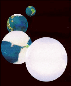
The pictured division of the continents occurred during the catastrophe
of Noah's flood. The days of Peleg was a political distribution of land.
The knowledge of this division was preserved well into the time of Moses, where the conquering of the land of Canaan was justified because that land was originally reserved for Shem and his descendants. However, Ham's descendants had conquered and occupied it illegally.

It is also interesting to note that the ancient Irish "Book of Invasions" points out that the original inhabitants of Ireland came from the tower of Babel and were descendents of Japheth. And Ireland is within the division that was allotted to Japheth.

The continents ended up in their current positions during the great Flood. Their shifting position was the principle reason for the devastation. (Read: The Most Recent Cataclysm WAS Noah's Flood After All) There is no evidence, either physical or historical, that another continental shift occurred during the time of Peleg. (Read: What Is Cataclysmic Continental Shift?)

Monday, May 1, 2017

The Snowball Earth Fantasy

The hypothesis that the earth periodically froze entirely
is more ridiculous than believing in a global flood.
Sometimes I just want to bang my head against the wall at the stubbornness of the established scientific community. Some are so arrogant and anti-God that when the evidence of a global flood is staring them in the face, they bend over backwards to invent an alternative.

What doesn't make sense to me is that there are people who are so adverse to accepting anything Biblical because it is the "stuff of fantasy." However, those same people will go and invent a totally new fantasy - and do it with a straight face!

That fantasy is the Snowball Earth Hypothesis.

“When men choose not to believe in God, they do not thereafter believe in nothing, they then become capable of believing in anything.”  G.K. Chesterton


When early geologists repeatedly found sediments, erratics, striated rocks and other evidence of massive and catastrophic flooding, they decided that, rather than believe it's flooding (because that would give credence to the Bible), they would pretend that it's evidence of glaciation. Sure, some of those resemble the true signs of glaciation, but we have to draw the line somewhere.

That line is the equator.

Earth did not freeze solid 650 million and 2400 million years ago. These mistaken interpretations are just leap-frogging themselves from plausible to stupid.


When you find evidence of widespread flooding in Europe or North America and you are dead set on not even giving a nod to the veracity of the Bible (not to mention the oral traditions of every single culture on the planet) then of course you are going to cast around and say, "ice."

So. . . Now you have convinced yourself that the evidence of the previous ice cap breaking up and flooding Europe and North America was instead slow glaciation. Then. . . what happens when you find the same geological features near the equator because of prior cataclysms? Naturally, you go and make the entire planet a snowball. And you do it without flinching!


This planet is an amazing creation. When it gets too hot, the extra water from melted ice and higher temperatures create additional water vapor and carbon dioxide that makes plants grow more abundantly. Then, the natural balance of climate reverses towards a cooling trend as the extra water precipitates back as cooling rain and snow and ice. And when it gets too cold the exact opposite occurs. If the ice sheets really did reach the 40th parallel, (except, oddly enough Alaska and Siberia,) then the world would spiral out of control and freeze entirely - and never return from it's Hoth-like state. But that only happens in the fantasy world of Snowball Earth theorists and those who blindly accept their nonsense.

In the real world, our planet's ice never did get to the 40th parallel. The recent "ice age" never happened. (Read more about the fallacy of Ice Ages here: The Last Ice Age Was Really Just the Ice Cap In a Different Position)

What really happened is that sometime between 3000 BC and 12,000 BC the tectonic plates shifted cataclysmically and the continents temporarily sank as sea floors rose, flooding the entire planet. The ice cap of that time broke up then reformed in a different position relative to the new positions of the continents. Almost every single "clue" that points to glaciation can also be interpreted as evidence of a catastrophic flood.

Again, the simple answer is the best answer. A world-wide cataclysm and flood it is more plausible than a snowball.

Additional reading:
The Last Ice Age Was Really Just the Ice Cap In a Different Position
Cataclysmic Continental Shifts: What Causes Them?
Atlantis Found: The Simple Answer Is the Best Answer
Is Most Published Research Wrong?